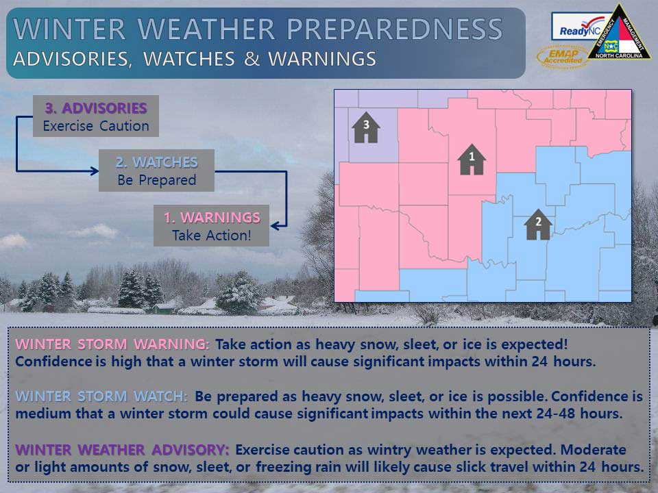
Winter weather is the most complex weather phenomena that forecasters face in North Carolina. Winter storms bring significant and sometimes rapid changes in the weather which greatly affects our lives and safety. Winter storms can develop and last for just a few hours or linger for days. Some of the worst winter storms in North Carolina producing heavy snow and ice have trapped people in their cars, and isolated residents in their homes without utilities and other services for over a week. Even small amounts of snow and ice can create havoc as residents of Raleigh learned on the afternoon of January 19, 2005 when just a half inch of snow froze onto major highways in the middle of the day. The freezing of the snow onto the road surface resulted in hours of gridlock stranding many motorists and school buses loaded with children for hours. Just a little bit of snow in combination very cold temperatures and the time of day can create dangerous conditions crippling major cities.
Winter storms result from a variety of weather patterns. North Carolina sits in the battleground between cold air from the north and warm moist air from the south. The timing of the cold air colliding with moisture streaming in from the Gulf of Mexico and Atlantic Ocean typically dictates the type of precipitation you see falling in your backyard. Geography also plays a large role in our weather. The Appalachian Mountains to the west and the warm waters of the Gulf Stream just off the coast both play vital roles in winter storm development. The mountains act to pile up cold air over the state while the warm waters of the Gulf Stream provide moisture and lots of energy to winter storms.
The most common and dangerous weather systems which can produce snow and ice are strong coastal low pressure systems known as nor’easters. Nor’easters are low pressure systems which develop over the ocean and track northeast along the coast. The reason North Carolina waters are so favorable for nor’easter development is due to the proximity of the Gulf Stream. When cold air rushes out over the ocean and the Gulf Stream, a very unstable and volatile situation is created. When this instability combines with the jet stream in the upper levels of the atmosphere, a massive low pressure system known as a nor’easter can develop.
Cold air damming typically impacts the central and western portions of the state. This occurs when cold high pressure over New York and Pennsylvania pushes cold air south into the Carolinas. This cold air is heavy and piles up against the mountains as it rushes south. The mountains act as a dam causing the cold air to deepen across the Piedmont and sometimes as far east as the Coastal Plain. When lighter, warm moist air coming up from the south overruns the cold air at the surface, freezing rain, sleet and snow can result.
Winter storms can make driving and walking extremely dangerous. The aftermath of a major winter storm can have a devastating impact for days, weeks, or even months. Winter storms can be deceptive killers because most deaths are indirectly related to the storm. People die in traffic accidents on icy roads, have heart attacks while shoveling snow, or succumb to fires or carbon monoxide while trying the heat their home improperly. However, with proper planning and preparation, you can limit or even mitigate the impacts from winter storms.
Winter Weather Preparedness Resources
- National Weather Service Winter Safety
- North Carolina Department of Public Safety
- FEMA: Winter Preparedness

