![]()
Topics
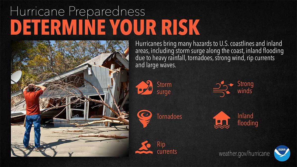
What Are The Impacts From Any Tropical System?
Did you know that hurricanes or any tropical system can have FIVE major impacts? These include storm surge, flooding, strong wind, tornadoes and rip currents. Today’s topic is determining your risk. North Carolina is one of the most hurricane ravaged states in the country. The entire state, from the mountains to the coast, is susceptible to hurricane and tropical storm impacts. The coastal areas of the state can be susceptible to storm surge, high winds, flooding and tornadoes. The central portion of the state can be susceptible to inland freshwater flooding, high winds and tornadoes; and the western portion of the state can be susceptible to tornadoes, flash flooding, and resulting landslides from heavy rains. Even when hurricanes stay out to sea, the North Carolina coast can still be impacted by large swells and deadly rip currents!
Why Should I Not Focus On The Category Alone?
The Saffir-Simpson Scale is a wind scale that uses WIND only to estimate potential damage. Unfortunately this scale does not tell you about ALL of the impacts that a hurricane can produce. It does not tell you how much rain will fall or how high the storm surge may be. It does not tell you anything about potential impacts from tornadoes or rip currents. It also does not give you information on how large the storm may be, or anything about the storm’s movement. In fact, water accounts for 90% of direct deaths from tropical systems, both from storm surge and flooding rain. Please keep this in mind this upcoming season. Pay attention TO ALL of the impacts from a storm and not just the category. Remember that Hurricane Florence was “just” a category 1 when it made landfall along our coast.
When Is Hurricane Season?
The most active months for tropical systems in North Carolina are August, September and October. However, hurricanes have impacted our state as early as May and as late as November! The peak tropical activity usually occurs in a six week period from mid-August to late September, during which time our state can experience multiple hurricanes or tropical storms within weeks of each other.
Hurricane Terminology
- Hurricane Warning: An announcement that sustained winds of 74 mph or higher are expected somewhere within the specified area in association with a tropical, subtropical, or post-tropical cyclone. Because hurricane preparedness activities become difficult once winds reach tropical storm force, the warning is issued 36 hours in advance of the anticipated onset of tropical-storm-force winds. The warning can remain in effect when dangerously high water or a combination of dangerously high water and waves continue, even though winds may be less than hurricane force.
- Hurricane Watch: An announcement that sustained winds of 74 mph or higher are possible somewhere within the specified area in association with a tropical, subtropical, or post-tropical cyclone. Because hurricane preparedness activities become difficult once winds reach tropical storm force, the watch is issued 48 hours in advance of the anticipated onset of tropical-storm-force winds.
- Tropical Storm Warning: An announcement that sustained winds of 39 to 73 mph are expected somewhere within the specified area within 36 hours in association with a tropical, subtropical, or post-tropical cyclone.
- Tropical Storm Watch: An announcement that sustained winds of 39 to 73 mph are possible somewhere within the specified area within 48 hours in association with a tropical, subtropical, or post-tropical cyclone.