![]()
Topics
- Sunday: Know Your Risk – Water and Wind
- Monday: Prepare Before Hurricane Season, Know Your Zone, Storm Surge
- Tuesday: Understand Forecast Info, High Winds
- Wednesday: Get Moving When a Storm Threatens, Inland Flooding
- Thursday: Stay Protected During Storms, Tornadoes
- Friday: Use Caution After Storms, Rip Currents
- Saturday: Take Action Today
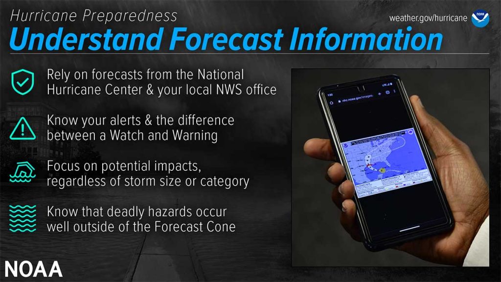
National Weather Service forecast products can tell you a lot about what is expected to happen with a storm, including the storm’s paths, rainfall amounts, wind speeds and more. There is a lot of information available days ahead of a storm, and it is important to understand what it means.
Have Trusted Sources for Storm Information
Rely on official forecasts and well-established media partners in the Weather Enterprise. Be cautious of sensational headlines and instead look for reliable sources to determine a storm’s potential impacts. Use the official National Hurricane Center forecast — their hurricane specialists access a variety of data (models, aircraft, satellite) to make the most accurate forecasts possible. Meteorologists at local NWS offices understand which locations in your area are most vulnerable to storm surge, flooding and wind. Always check to make sure you have the latest forecast information. Make sure to have Wireless Emergency Alerts enabled on your phone to receive Warnings.
Know Your Alerts and the Difference Between a Watch and Warning
In general, a Watch means impacts are possible; a Warning means impacts are expected or happening. Different hazards and alerts require different responses:
- A Hurricane Watch means hurricane conditions are possible somewhere within the watch area, with tropical-storm-force winds beginning within the next 48 hours. Prepare by boarding up windows and moving loose items indoors and make sure your emergency kit is ready. A Hurricane Warning means hurricane conditions are expected somewhere within the warning area, with tropical-storm-force winds beginning within 36 hours. Seek shelter in a sturdy structure or evacuate if ordered.
- A Tropical Storm Watch means tropical storm conditions are possible within the next 48 hours. A Tropical Storm Warning means they are expected somewhere within the warning area. Remember, a tropical system does not have to reach hurricane strength to be deadly.
- A Storm Surge Watch means the possibility of life-threatening inundation generally within 48 hours, and a Storm Surge Warning means the danger of life-threatening inundation generally within 36 hours. In either case, please promptly follow evacuation and other instructions from local officials.
- An Extreme Wind Warning means extreme hurricane winds (115 mph+) are imminent or happening: take immediate shelter in an interior portion of a well-built structure.
- A Flash Flood Warning means dangerous flash flooding is expected: move to higher ground, and never walk or drive through floodwater. A Flash Flood Emergency is issued for exceedingly rare situations when a severe threat to human life and catastrophic damage is happening or about to happen — do NOT attempt to travel unless you are under an evacuation order or your life is imminently at risk.
- A Flood Watch means flooding is possible: stay tuned to trusted news sources and be ready to seek higher ground. A Flood Warning means flooding is happening or about to happen: move to higher ground immediately.
- A Tornado Watch means a tornado is possible: know your safe place and be ready to act quickly if a Warning is issued. A Tornado Warning means a tornado is happening or about to happen – immediately seek shelter in your safe place!
Deadly Hazards Occur Well Outside of the Cone
Impacts can be felt far from the storm’s center, even well inland and outside the Forecast Cone. Remember: the storm itself can stretch well beyond the Forecast Cone, and so can the impacts. The National Hurricane Center Forecast Cone shows the probable forecast track of the center of the storm. This means that the storm’s center will probably travel somewhere within the cone’s boundaries. (Historically, the storm’s center has remained within the forecasted cone roughly two-thirds of the time.) The cone does NOT represent the size of the storm in any way.
High Winds
Keep in mind that even tropical storm force winds (39 to 73 MPH) are capable of tossing around debris and causing damage. For this reason, you should seek shelter from the wind in a sturdy building as the hurricane moves inland and before the onset of tropical storm force winds. Tropical storm force winds usually strike hours ahead of the actual hurricane’s eye. For this reason many emergency officials typically have evacuations completed and personnel sheltered before the onset of tropical storm force winds.
Hurricane force winds can easily destroy poorly constructed buildings and mobile homes. Debris such as signs, roofing material and items left outside become flying missiles in high wind. Falling trees cause extensive damage to power lines, towers and underground water lines. This can cause extended disruptions of utility services. Damaging hurricane force winds can be just as devastating as tornadoes.
Identify Your Trusted Sources of Information
NOAA’s National Hurricane Center is your official source for hurricane forecasts and the issuance of hurricane watches and warnings. Your local NOAA National Weather Service forecast office provides information regarding the expected impacts from the storm for your area. Emergency managers will make the decisions regarding evacuations.
Organizations such as FLASH make disaster safety recommendations, and the media outlets will broadcast this information to you. All work together to be your trusted sources, especially for those less able to take care of themselves.
Here are some additional suggestions regarding where to get trusted tropical storm and hurricane information:
- Television: Tune in to your trusted local news source.
- Phone: Access mobile.weather.gov on your mobile phone and get Wireless Emergency Alerts.
- Radio: Receive forecast information and news on your NOAA Weather Radio.
- Social Media: Follow official government agencies, trusted media partners, and share critical information with friends and family.
- Computer: Access information from weather.gov, ready.gov, readync.gov, and flash.org.